
 Surprisingly there was enough time after finding Bigfoot to go explore another location. Katherine wanted to check out some ruins so I came up with a few options and we ended up just trying to go to the closest one which was only fifty minutes out from where we were. It turned out to be Fort McClary, yet another historical landmark I knew nothing about. We typed the address into the GPS and hoped for the best.
 It was another hot day but luckily I was in a car with air conditioning, which was a nice change. We had been together now for long enough that our happy burbling had gone from the usual pleasantries to discussing in depth only the most fucked up subjects we could think of – like what we thought was normal when we were kids that really wasn’t, what left the deepest psychological scars, and what was rotting behind each white picket fence in the small towns we grew up in. It was all in good fun and I think we were both enjoying it – though I have to wonder if my company is extreme when I keep eliciting gasps of horror. Perhaps next time I will keep nail clippers in the car so that when I flip a nail inside out and get it bleeding I have something a little more appropriate to remedy the situation that a rusty set of needle nose pliers… maybe.
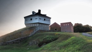
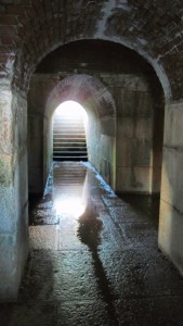
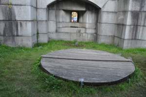 Anyway, we got stuck in traffic for a bit where I got into a fight with another Prius who would not let me move over into the exit lane I actually needed… but we survived and no one was shot so it’s all good. When we drove up to the fort the tiny parking lot was almost filled to capacity with cars. People were here with their kids and dogs and we could already see a few pieces of the fort and the boat filled harbor it guarded. Unlike Fort Edgecomb this place seemed to be completely open for the public to climb into and explore. There was a nice round fort with cannons and artillery windows as well as the captain’s quarters and there were a number of other structures and partial structures scattered about both above and underground just waiting to be entered. Inside the main fort there were displays and plaques and some of the scariest stairs I have ever seen in my life. The windows provided a beautiful birdseye view of a whole fleet of boats out in the harbor as well as two lighthouses in the distance.
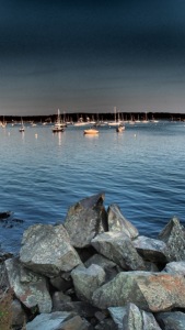 It was a small property but so lovely to wander I enjoyed snapping photos and Katherine relaxed with the smell of the ocean wafting in. We picked a couple locations to just stand and watch the waters as we talked, not really wanting to leave until it got dark. We outlasted almost everyone there and when there was only one other guy wandering about we managed to scare him off with our frank discussion of birth control. Always nice.
Really liked this place – it had the history of being involved in five wars, the added charm of having some ruins which looked oddly Arthurian at times, and the coast was just too beautiful not to want to while away the hours staring at it.
If you are enjoying Catching Marbles please consider adding a dollar or two to my limited gas money fund so I can continue going on adventures and sharing them with you! Thank you!


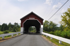 The first bridge I came to was the Carlton Bridge on Carlton Road. Super easy find! I drove right to it! It was nestled between a lot of farmland and some houses, a really pretty area and there was a turn off to park. It’s a one-lane two-way bridge which isn’t unusual, luckily there was no traffic and better still there was a delightful little path that went down to the bottom of it where I could splash in the water and play with the camera. It was quiet here and quite beautiful. I was delighted by this. You go to one covered bridge and you sort of feel like you’ve seen them all but this one was just so sweet, so serene, that it really made me instantly fond of it. Other people were too. I got a few people slowing down to check out Daisy’s lovely new tatts and just as I drove away an old man pulled in, smiling.

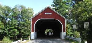 The next bridge was on Sawyer’s Crossing. My GPS didn’t seem to know which road was Sawyer’s Crossing and this area was super confusing, filled with all sorts of winding roads all connecting to each other in what I can only say is the most disorienting rat’s nest of turns I have seen in a long long time. I did eventually find the bridge by looking for a river on the GPS map and going towards it. However by this time there was a sports car behind me, nudging Daisy’s poor ass, so I had to go over the bridge instead of stopping. As it turns out there’s no place to park, AT ALL. There’s no parking lot, no turn offs, you could barely pull over aside the road far enough to let another car go coming form the other direction. It was weird. I found three trails down a nearby road but not their beginning, just their middle which went across the road. My curiosity was peaked but I didn’t really know how to explore that further. Instead I wound over that damn bridge two more times, both times a car appearing out of the middle of nowhere to ride my bumper. I got annoyed, never did manage to snap a photo, though it looks much like the other bridge, just lacking in the quiet charm.
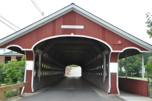 The third bridge is called Thomson Bridge and it is right on Main Street, has a pedestrian walkway right over it, and ample parking! I couldn’t have asked for better! Instantly I liked this bridge too. It was bigger but still only one lane for cars and one for pedestrians. It spanned a lovely river and a dam which apparently doesn’t exist anymore. It was such a drop dead gorgeous day I loitered and took marble photos for quite a while. Some cars passed but not many and going back to the car I was struck by how beautiful the decaying wool mill behind it was. I wanted to explore that further so I hopped in my car, turned it on, drove over the bridge, and turned down a nearby street to see the ruins better.


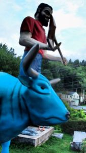 To end one day’s worth of chasing waterfalls I drove up to Rumford falls just as it was starting to get a bit dark. I hadn’t realized this was also the location of another one of the things on my list of roadside attractions – a giant Paul Bunyan statue complete with Babe the big blue ox!
 Sadly I showed up at the wrong time of year and the falls were completely dry… nothing really to see here except a series of weird Indian Cut-Outs?? I guess Maine hasn’t been seen by the PC police yet… but anyway! If you’re going to go see this, go in the spring when there is a flow! Unless you’re just here to take cheeky photos with Paul Bunyan…. he’s out in the parking lot and just as tacky and hilarious as he looks. Great opportunity for selfie mischief! I would say I look like a total dork with my jeans still rolled up from playing in the water but then I realized I’m hugging a big blue ox soooo…..
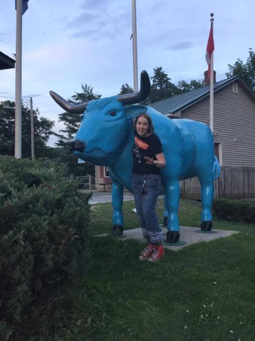


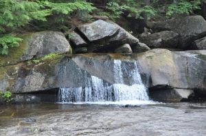 Screw Auger Falls was another one of the waterfalls listed on the
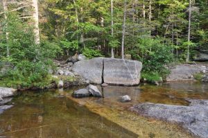 But with that all said and done Screw Auger Falls was an awesome little spot. Besides having two waterfalls within easy walking distance the smaller of the two allowed for a local swimming hole where children splashed about in the shallow water. Adults mostly loitered around the edges because this place was made of natural granite which had been worn very slick and smooth by the erosive nature of water and perhaps by retreating glaciers before that. On top of that algae grew over many bits which made for an intensely slick surface. None-the-less I had been driving all day and it was in the 80’s. Despite my lack of swimwear I decided to roll up my jeans, lop off my trusty Converses, and wade right in! The water was just above where I had rolled up my jeans at the deepest point across the river where I had started. It had taken me a good ten minutes to get this few feet because of the slick nature of the rocks. Children here knew how to navigate this danger as they slid around on their bellies like joyful seals. It was a sight to see! When I managed to get into this somewhat deep spot I bent down and splashed in the water letting it whoosh over my face and arms, essentially bathing in the river with my clothes still on.
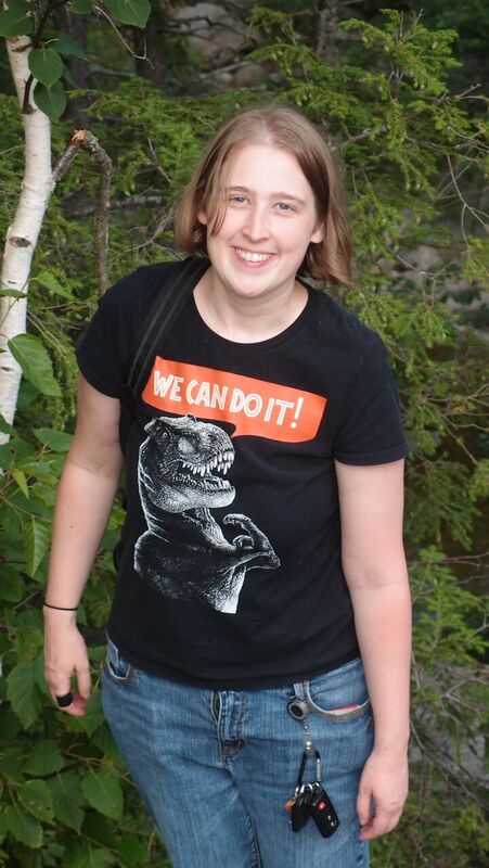 The ice cold water felt almost baptismal in a way. I’ve been playing in a lot of rivers these past few months and every time it’s the same – the healing properties of the waters come from the psychological boost you get when you can almost feel all the negativity in your life just washing over your skin and tumbling down stream never to be seen again. At long last I was encouraging my true hippie nature to come out and play. How joyful I have been getting back in touch with the beauty of New England, and cranking up the radio as I go – singing along loudly and badly to Led Zeppelin, Jimi Hendrix, Janis Joplin, and all the music I had stopped listening to over the years when I never should have. The raucous screaming guitars and belted out rhythmus soothing my soul. At night I escape into another long forgotten guilty pleasure – beatnik literature, now with far more bite and meaning with my age and life experience. It’s interesting to almost reach back in time and touch another generation with such a powerful wanderlust. In addition to this seeing all these new beautiful places and meeting so many wonderful people had relit something powerful and intense in my heart – such a strong feeling of connection and wonder. In remembering who I am I learned who I need to be.


 So after taking that little detour to
 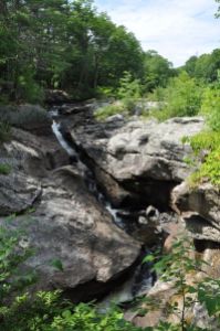 Still, the trails that headed over to the falls were short, easy to walk, and provided far more beautiful a scene than I had expected. Apparently the falls were named after Captain Snow who had a camp set up just about where the picnic tables are. He was a fur trapper at the time living out in the wilds of Maine pretty far from any real white settlements. This may be why he ultimately died during a brutal Indian raid – easy pickins’ I suppose. The tale tells of an Indian chief leading the raid wearing an entire eagle over his head, it’s wings outstretched, and it’s beak agape. Quite an image! This happened sometime in the 1750’s or 60’s, as several historical accounts contradict each other.


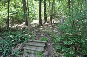 On my list of destinations I had several “castles” and estates that have been turned into public spaces for whatever reason. This was one of them and was situated at the end of a trail. There was supposed to be a trail head behind a local restaurant but there was also another entrance down a nearby dirt road – again a hard find. It was a set of steps aside the aforementioned road with a tiny cut off on the other side. Though it was poorly marked it was marked so we headed into the woods not really knowing what we’d find. Turns out hills. We found one steep hill after another that went deeper into the forest before dumping us out into a pasture and then at the top of the last hill a phenomenal view of everything below – a beautiful pastoral scene sprawled out ahead of us framed in the distance by the blue ridges of a mountain. A tractor plowed back and forth and a field of lilacs added additional color. I was already happy and we hadn’t even found the castle yet!


 winding our way from the
